Introduction
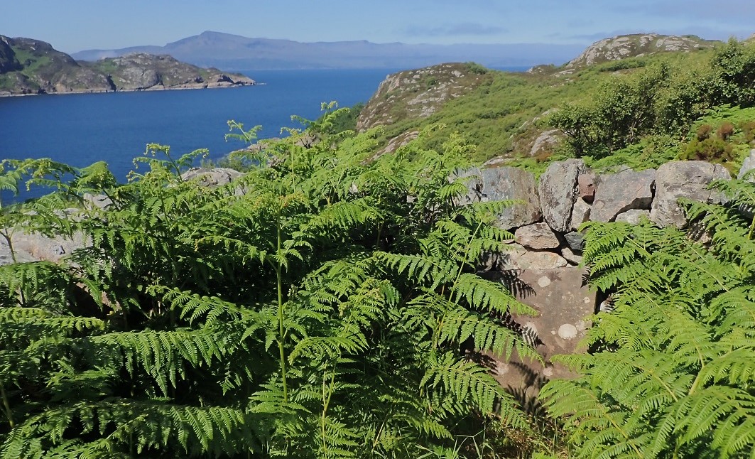
Rona, Acairseid Mhor anchorage with Skye in the background
Location
Information
Rona
Rona (Scottish Gaelic: Rònaigh) lies north of the neighbouring island of Raasay and east of the Trotternish peninsula of Skye. The Kyle of Loachalsh and Skye Bridge are only 20 miles to the south. It has a total area of 930 hectares (3.6 sq. mi) and a population of 3. Rona’s highest peak, Meall Acairseid, is 125m high
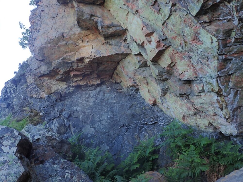
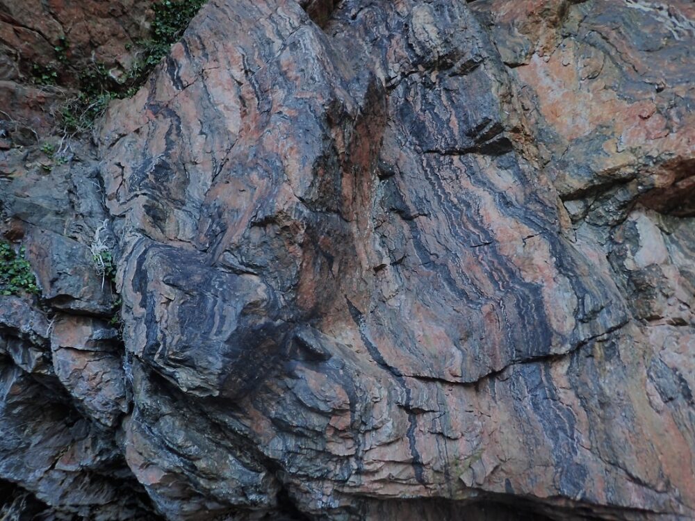
As with many Scottish islands its geology is ancient Lewisian gneiss Lewisian complex – Wikipedia and the glaciated landscape is underlain by some of the oldest rocks in western Europe.
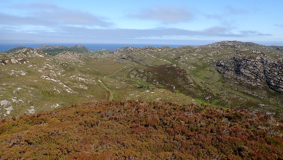
Looking at the island on an Ordinance Survey map portrays and rough rocky place with few paths and few settlements. Rona’s name is believed to be of Old Norse origin, from Hraun-eyer meaning “rough islands”. The Gaelic name Rònaigh has a similar meaning. Writing in the 18th century Martin Martin wrote “this little isle is the most unequal rocky piece of ground to be seen anywhere: there is but very few acres fit for digging”
My visit Summer 2018
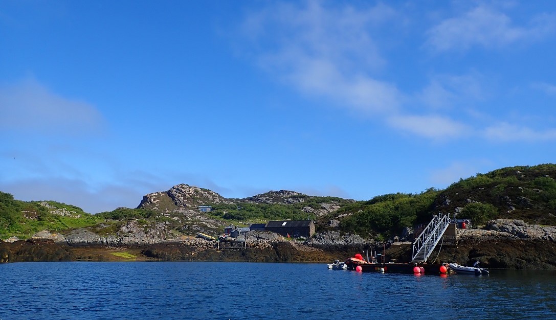
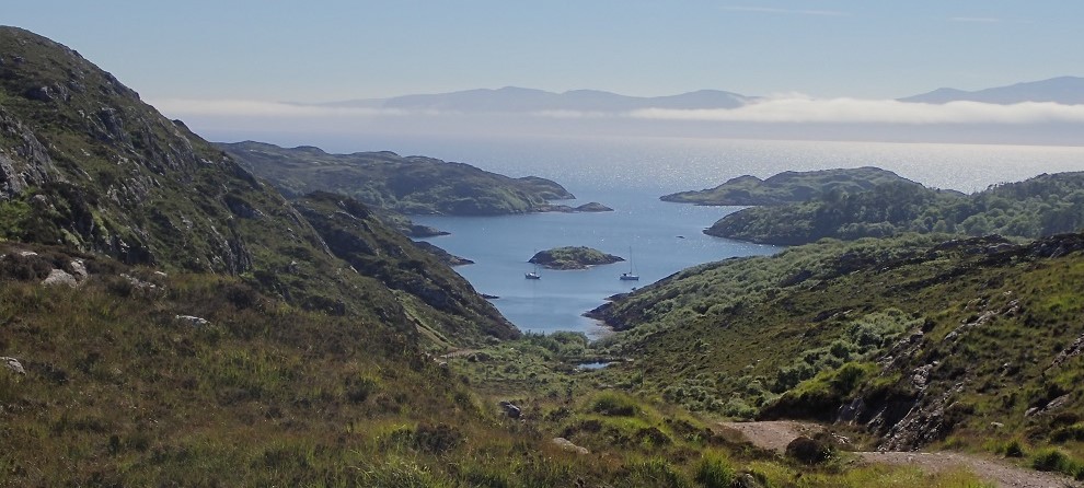
I set sail from Ullapool and completed the 76 mile voyage without incident. On arrival at Rona I navigated the narrows into Acairseid Mhor. The Gaelic translates to Big Harbour and how descriptive this is. The ‘harbour’ is all but invisible from the open sea to the west. The channel is narrow and winds between reefs and rocky shore. In the 16th century Rona became a refuge for pirates who made a base at Acersaid Mhor, then known as Port nan Robairean – “port of the robbers”. Due to the hidden nature of the inlet, it was a secure hiding place from which to pounce on passing trading ships.
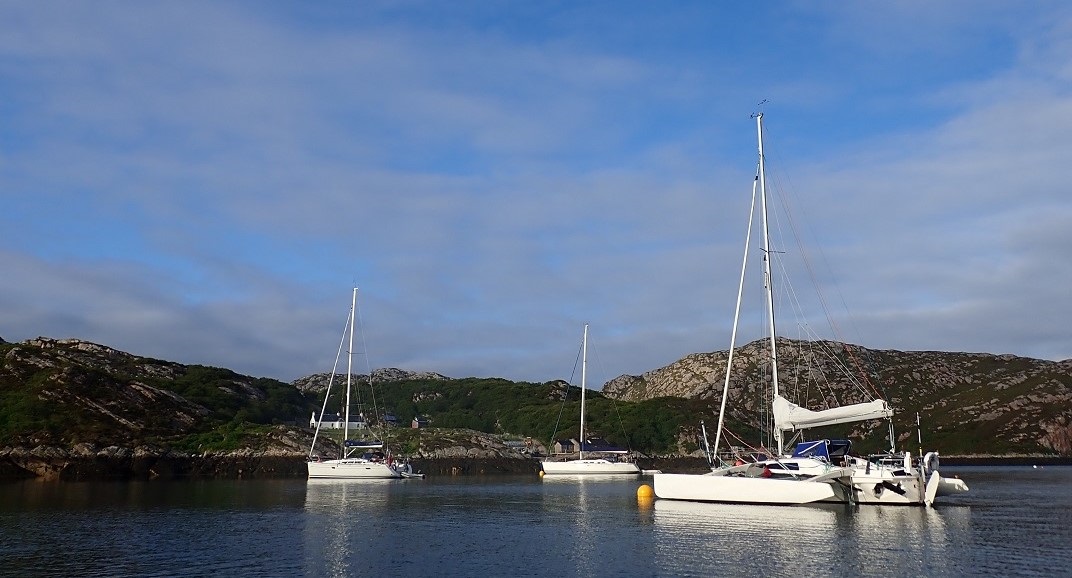
I arrived in peace and and with no skulduggery in mind. Fortune was with with me as I picked up the last available visitor mooring buoy.
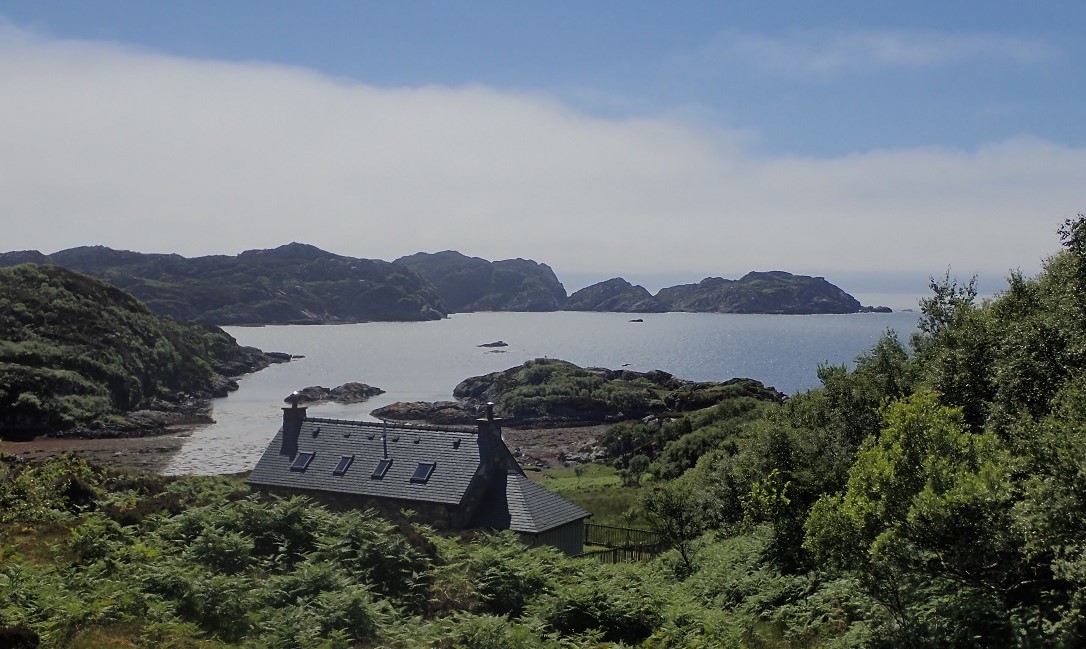
I set off to the shore and tied the dinghy to the landing jetty. It was a hot day and the visit to Rona promised to be a classic. The path up from the pontoon was a delight of deciduous trees and bushes and took me passed Rona Lodge.
South to Am Teampull
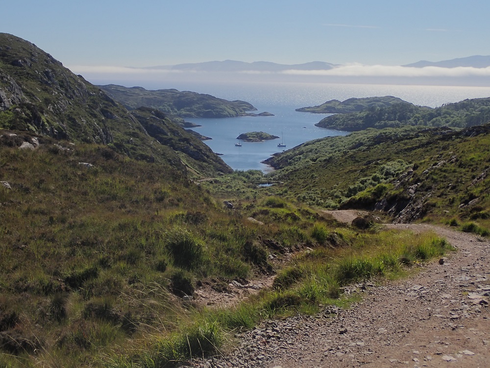
I picked up the main north – south path and elected to head south. The track was well founded if not a bit lumpy in places, but a good running surface. Over to the right lay Acairseid Mhor with the yachts lying in the shelter of the natural harbour. It was a hot day for running. At one point I left the path and ventured up a steep scramble of a slope to a high vantage point. From there was a stunning view over to the Applecross mountains on the mainland. Returning to the main track I came to the remains of the Doire na Guaile settlement.
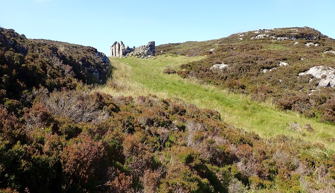
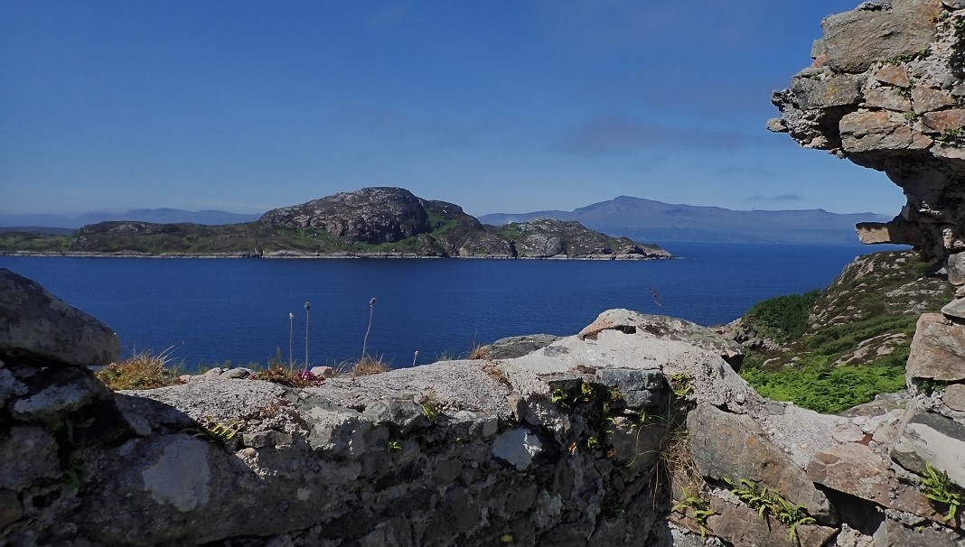
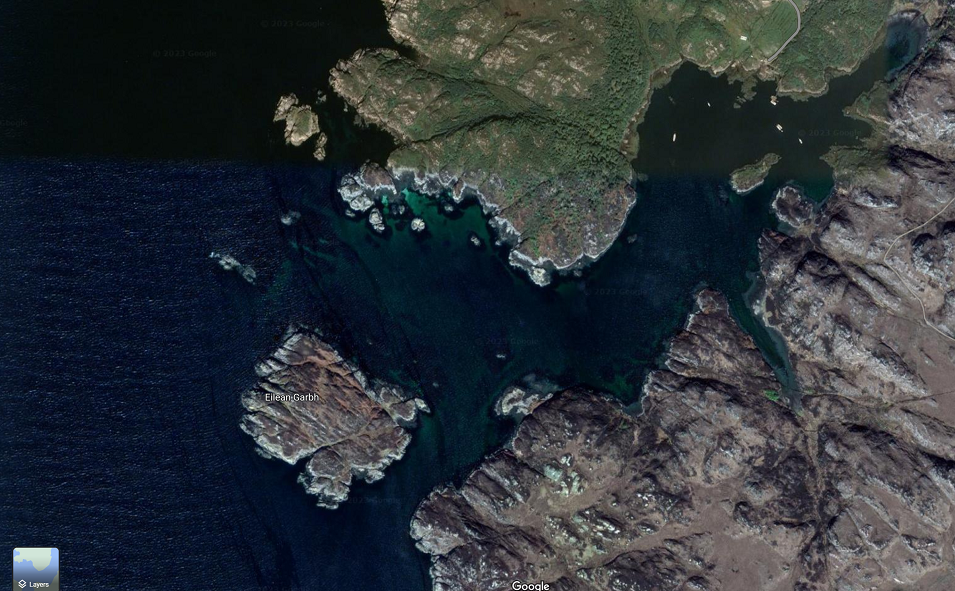
On reaching the south end of the island I found the ruins of the 14th century chapel An Teampull. The ruin sits on the most southerly patch of land where a building can sit. Below lies, rocks and steep drop to the tidal spit joining the island of Garbh Eilean. (Heather Island)
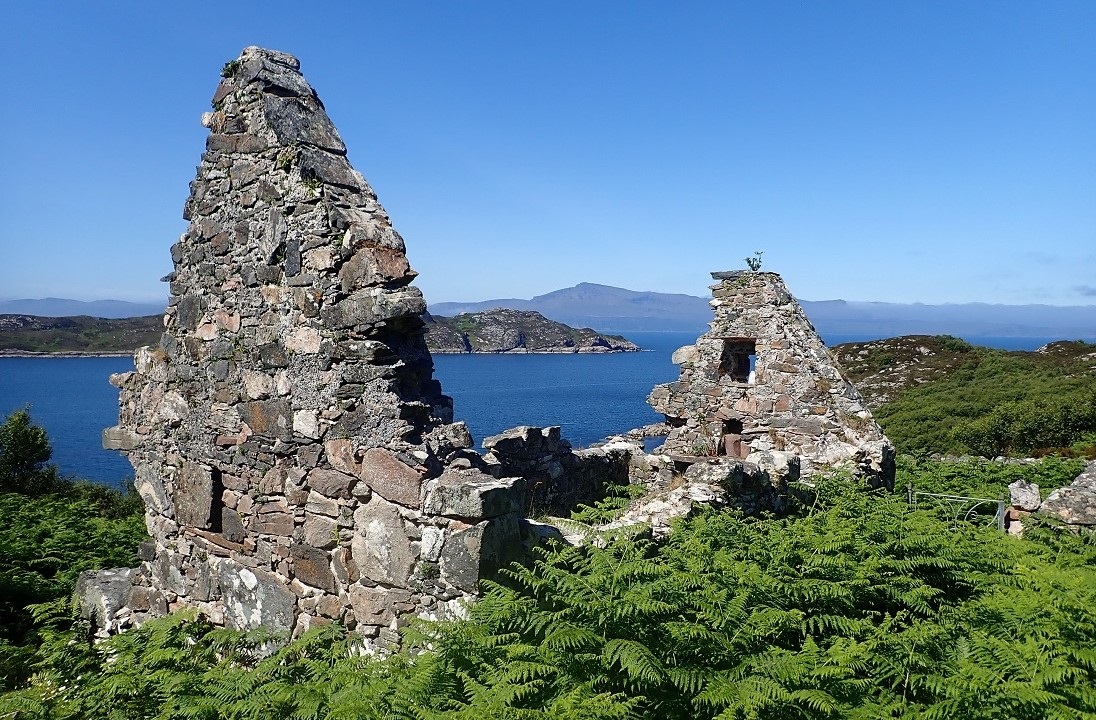
The ruin is enclosed by a wall within which is the island’s only gravestone. The gate into the walled area around what is believed to be a monk’s cell was jammed shut. I clambered over the wall and wandered around the remains. As with many Scottish west coast places of worship the location was breath-taking. Over to the west lay the vast island of Skye with Raasay off to the south. Standing in this remarkable peaceful and stunning location it is easy to let your mind wander off to imaging the holy life the devout men of god followed in these ‘pure’ surroundings.
Turning North
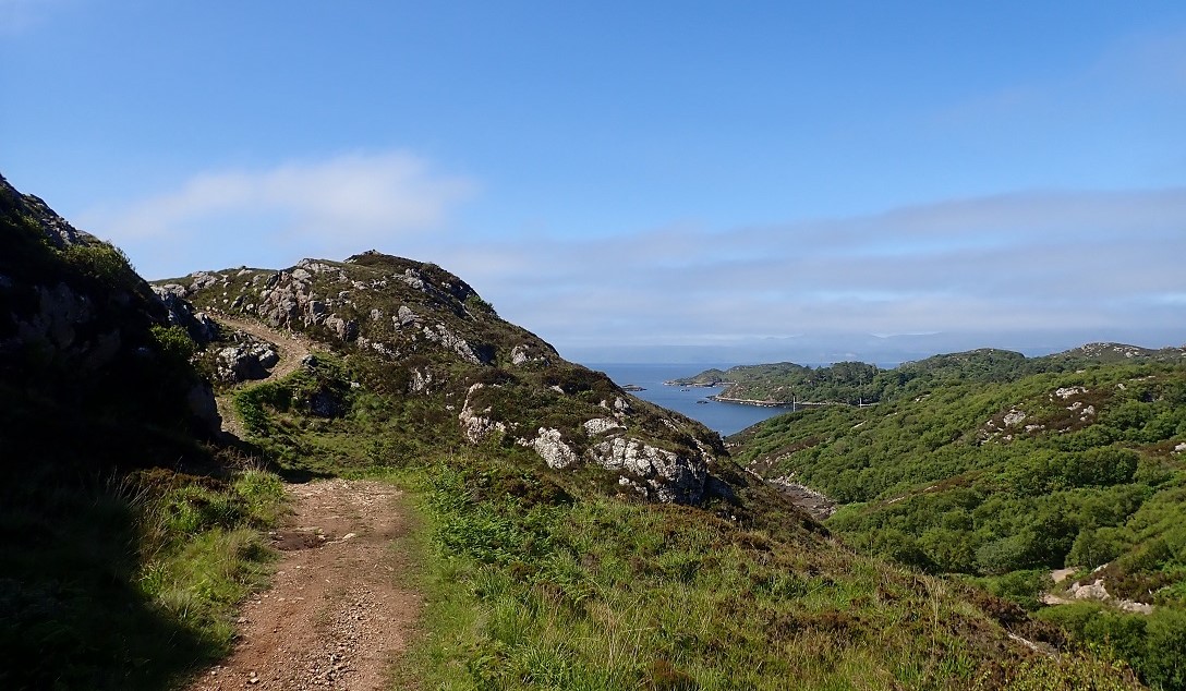
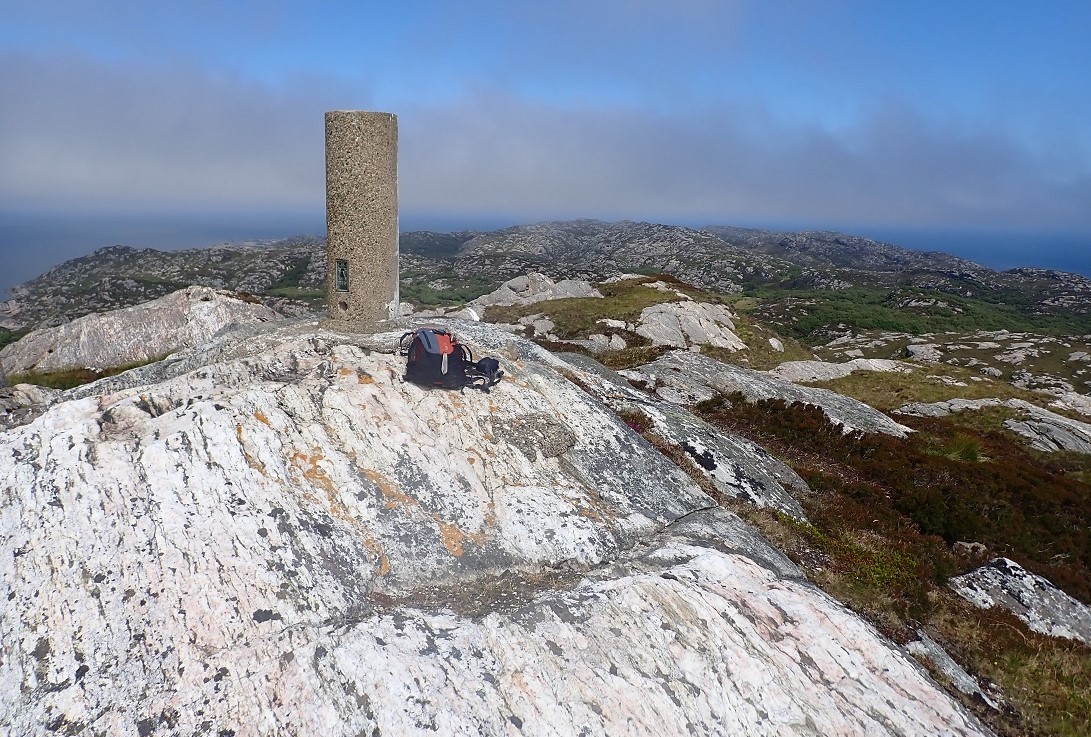
With some reluctance I turned north and set off on the 4 mile run to the north of Rona. The run north was an event! On passing the anchorage I split off left up a steep path to the summit of Meal Acairseid, at 125m the islands high point.
With the top bagged I carried on north in what was by now a swelteringly hot day. I passed Acarsaid Thioram (Dry Harbour) and the old school and renovated self-catering cottages. From Dry Harbour the path takes a rise then descends to the ruins of the main township. It is a sorry looking place with life gone and never to return.
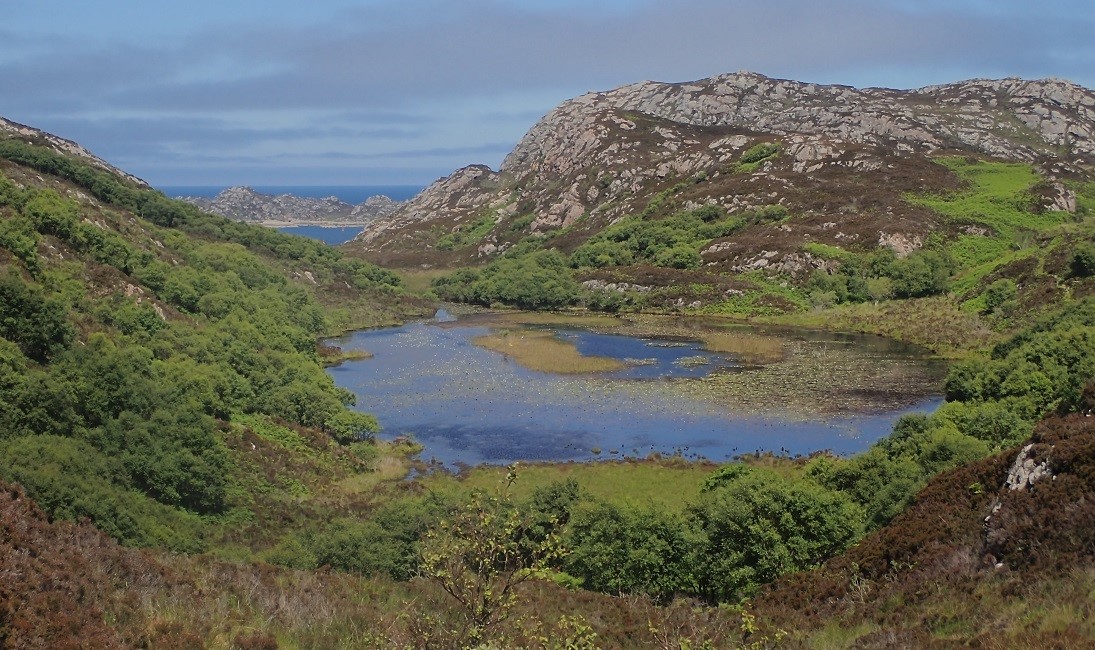
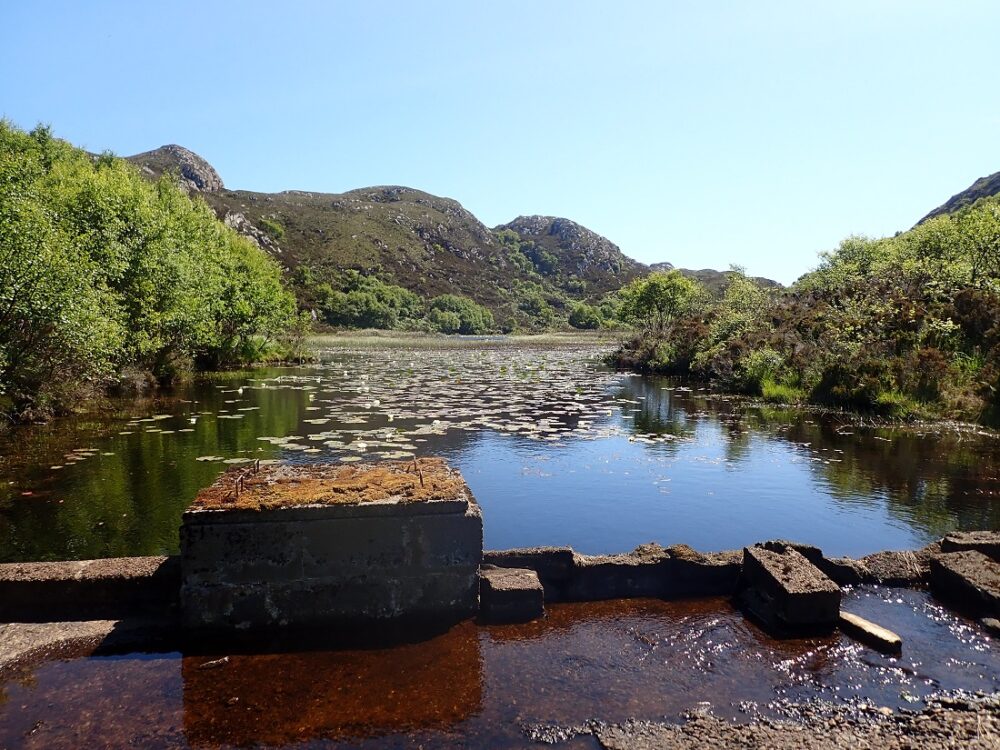
On cresting the next slight rise in the path, I came in view of Loch Braig. The loch was man made for sport. Dammed at the north end by a weir. It is now a wonderful freshwater haven for an abundance of water lilies, reeds and grasses. On this perfect day the water surface was teeming with dragon flies and pond skaters. Not far beyond Loch Braig the path petered out and I was soon clambering through rough heather, rock, and undergrowth. The ground north was to provide some hard graft, rock scrambling and shin grazing deep heather.
Rough Going
I mused how the terrain matched Martin Martin’s less than glowing 1703 commentary. It also served to reconfirm in my mind how hardy the folks of yesteryear had been. Calum MacLeod (of Raasay Road Fame) was for a time the Raasay postman. To discharge his duties he would row from Raasay to Rona. Thereafter, walk the entire length of Rona to deliver the post to the Lighthouse. He would then retrace his steps, a journey of 30 torturous kilometres!
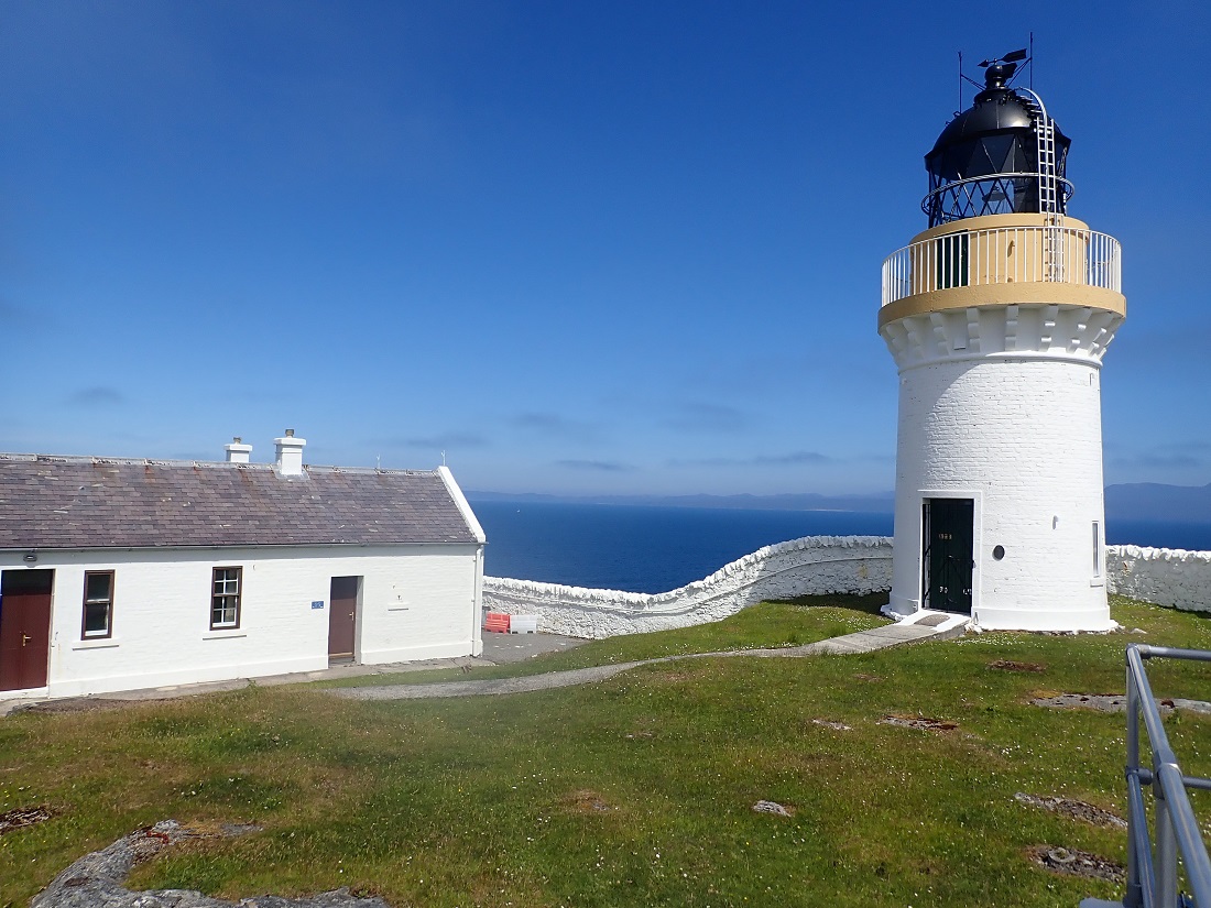
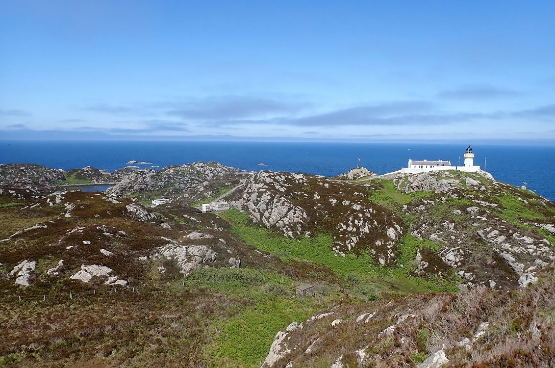
I emerged from the ‘rough lands’ to the concrete road that serves the lighthouse and the military base. After a quick tour of the Lighthouse I headed down to the harbour. It was all very surreal. Trucks and jeeps were parked outside, and doors lay ajar in the buildings. There was not a sole to be seen. I made my way down to the harbour, took in the views and decided it was time to make a sharp exit! The site is understood to be a deep-sea listening post and perhaps the staff were doing just that.

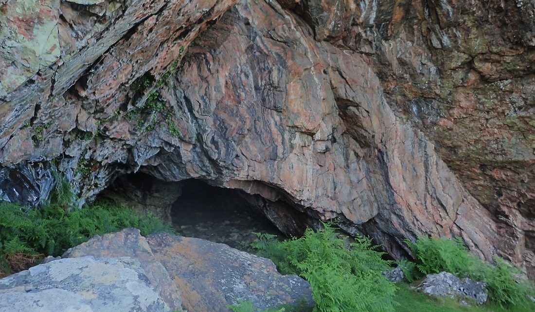
In Search of Church Cave
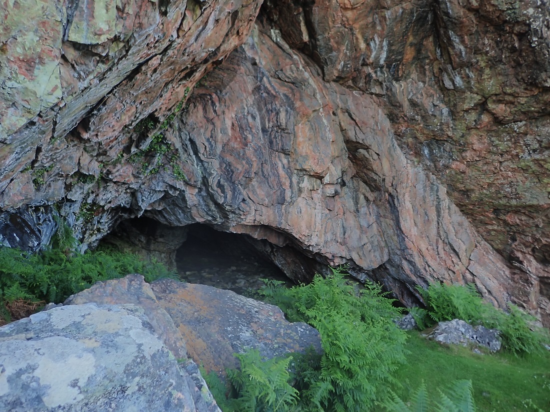
Leaving the base behind I followed what can only be described as a very faint path. I worked my way back to the Loch Braig. This low section was boggy with tussocks of grass lying in wait to twist an unsuspecting ankle. Loch Braig looked stunning from the weir, again a place teeming with life. From there it was a slog south in the heat back to the path junction to the Meal Acairseid peak. Here I turned left and to the east in search of Giant Cave, now known as Church Cave.
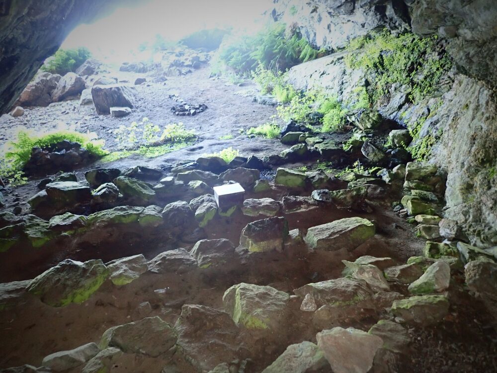
The path and part boardwalk followed the contours of the grass, heather, and boggy area to the top to the eastern cliffs. From there you follow a steep rocky path down a ravine with rope handhold guiding you to a ledge on the cliffs. From there the path leads to the Church Cave. The cave was used for Sunday worship until the church was built in 1912. The Gaelic name of the cave is “Uamha an Fhuaimhar”. Translated as the “cave of the giant”. Neat, curved rows of stones act as pews with a larger stone as the alter. I could not help but feel this arrangement was a bit staged. Did the worshipers really squat in tight huddled rows? I remain unconvinced by the scene.

A grand out day on Rona
I scrambled back up the steep path and returned along the path and board walk. From there it was not far back to the road down to the harbour. On the way down I passed a group of some 15-20 people making their way inland. Moored in the bay was a large gaff rigger, clearly, they were a group on an adventure sailing trip. They had the look of expectancy, as I had shown a few hours and few miles earlier in the day. Now I was desperate to rest. I was tired, very hot and dehydrated. Once back down at the landing pontoon the sea was too tempting, so I waded in to cool off. Refreshed by my plunge I jumped in the dinghy and paddled back to Trade Winds.
The evening on Trade Winds was a real pleasure. This, a result of the total ‘high’ provided by the run on a new island and the calming pleasure of being on a boat on a beautiful anchorage. A large meal was swiftly despatched along with some beers. The day on Rona was concluded with some friendly exchanges with fellow ‘boaters’ sharing the joys of Acairseid Mhor.
History
The island was held until the middle of 19th century by the Clan MacLeod. In the late 1780s MacLeod of Raasay attempted to develop commercial fishing on the island. Macleod found no financial backers, this due to his support for the Jacobite cause. Deep in Debt Macleod was forced to sell and in 1843 the islands of Rona and Raasay were sold to George Rainey. Rainey like many new ‘southern’ landowners set about clearing the native population of neighbouring Raasay to make way for sheep.
This Scottish island like many others was viewed as an asset and not a place of life for multi-generational residents. Many displaced islanders opted for the much poorer lands of Rona to the uncertain opportunities across the Atlantic.
Changes of Ownership
The next owner was George MacKay who forced up the rents and within three years had sold the islands for great profit to William Armitage. Only 18 months later the island once again changed hands to Herbert Wood. Wood saw the island as a blood-sports playground and imported deer, pheasants and rabbits. He also cleared the best agricultural land on Raasay which putting even more pressure on Rona.
The population of Rona rose to over 180, the main settlements being at Doire na Guaileadhin the south, An Acersaid Mhór and An Acarsaid Thioram.
Life continued to be a struggle and in 1889 the small settlement in the north at Braig was abandoned.
Raasay Raiders
Fast forward to the 20th century and in 1921, a group of crofters from Rona landed on Raasay and attempted to re-occupy their ancestral land. The “Raasay Raiders” were arrested, tried, and given jail sentences for their troubles. Public support for them was strong and they were eventually freed and allowed to re-settle on Raasay.
The incident created headlines and saw the islands of Raasay and Rona purchased by the Scottish Board of Agriculture in 1922. The result of which saw the population of Rona fall sharply. After this exodus to Raasay, the Macraes’ being the last crofting family left in 1943. The island had become uninhabited. The only exception to this was the lighthouse keepers until the lighthouse was automated in 1975 and the transient staff at the MOD base
Current Ownership
In 1992 the island of Rona was purchased from the government by a Danish owner who bought Rona from the MOD in 1992 for a mere £250,000. Mrs Jensen has restored Rona Lodge at An Acairseid Mhór, and built a new landing jetty. Rona currently has two permanent residents, the island manager and his wife, who live at Rona Lodge (where B&B and bunkhouse accommodation are available), and who also manage the self-catering cottages at An Acarsaid Thioram.
To her credit Mrs Jensen has overseen sensitive renovations so retaining the wonderful ambiance of Rona. The lack of sheep has helped the regeneration of native woodland and wildflowers.
Island Stamp and Visiting Rona
A Rona Stamp has been issued on the island since 2003. The stamps serve visitors who wish to have their mail posted from the island.
Getting to Rona
Rona is a delightful Scottish island but will take two of three days at least to really get a feel for the place. It is as Martin Martin described and my feet will testify as being as ‘the most unequal rocky piece of ground.’ However that and its unspoilt ambience make it a fcainating place to visit. Accommodation is available at www.isleofrona.com There is also an intriguing seafood and luxury boat trip offer available from https://seaflowerskye.com The Rona https://seaflowerskye.com/tours/full-day-rona-and-raasay-tour-with-seafood-lunch/ trip starts off from Portree ion Skye. If you can, visit Rona and put some distance between hectic life and life on an idyllic Hebridean island.
Anchorage
Acairseid Mhor anchorage is one of the most renowned shelters for yachts and pleasure boats on the West Coast of Scotland. Pilot books provide detailed instructions advising recommended routes into the inner bay. The outer entrance is well hidden and not easily picked out from an distance. The course is a series of S bends and the rewards do not disappoint. A number of visitor moorings are laid with options to anchor a plenty. Acairseid Mhor lives up to all its hype and is a must to visit, and a place not to be rushed.
Nearby Scotislands
Sources
Fraser Darling, F. & Boyd, J.M. (1969) Natural History in the Highlands and Islands. London. Bloomsbury.
Martin, Martin (1703) “A Voyage to St. Kilda” in A Description of The Western Islands of Scotland
Haswell-Smith , Scottish Islands The Scottish Islands – The Bestselling Guide to Every Scottish Island by Hamish Haswell-Smith – Canongate Books Cannongate 2004
Image Gallery