Introduction
Handa
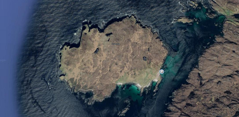
The island of Handa (Scottish Gaelic: Eilean Shannda) lies off the west coast of Sutherland north west Scotland. The island’s name Handa is of mixed Gaelic and Norse origin and means “island at the sandy river”.
Location
Information
Handa
Experience the Majesty of Handa Island: A Scottish Seabird Sanctuary
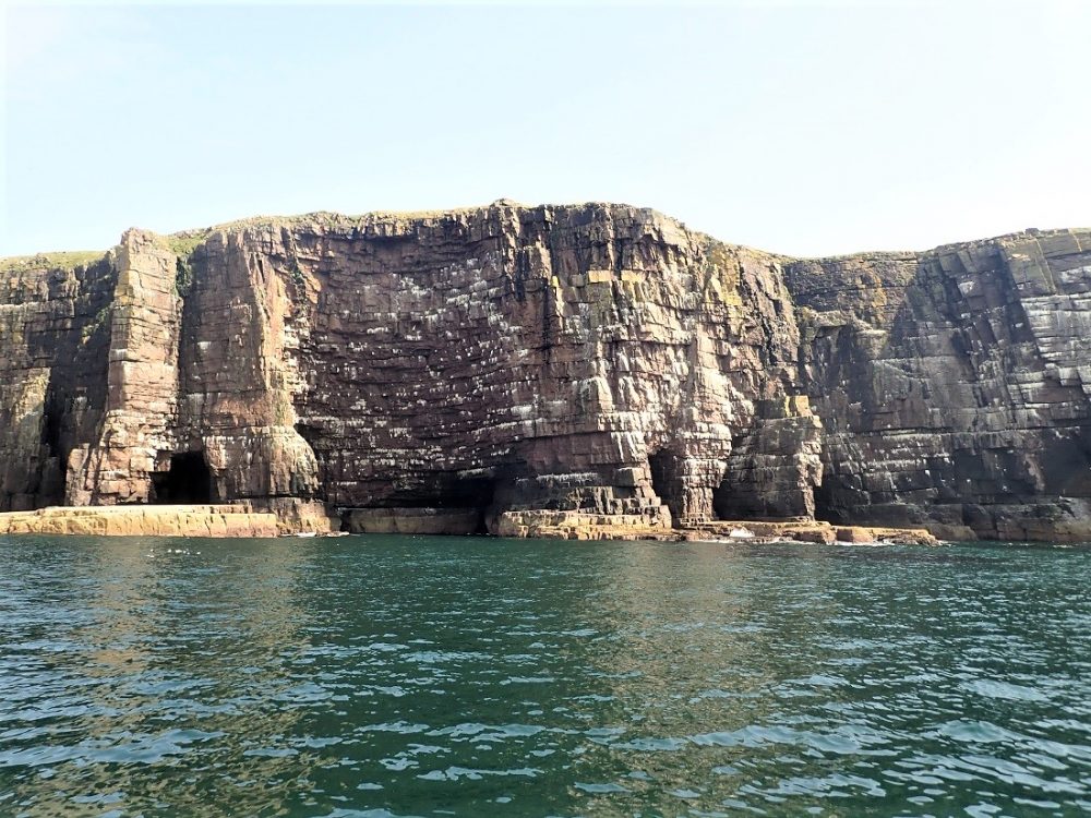
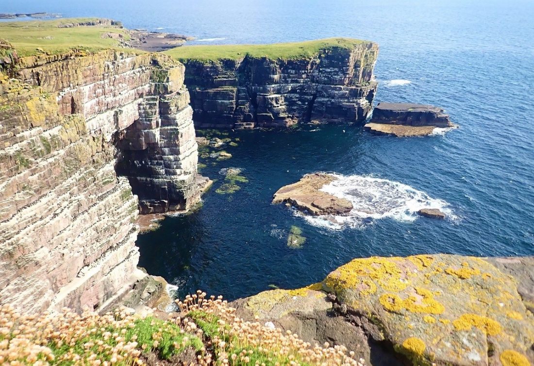
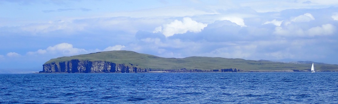
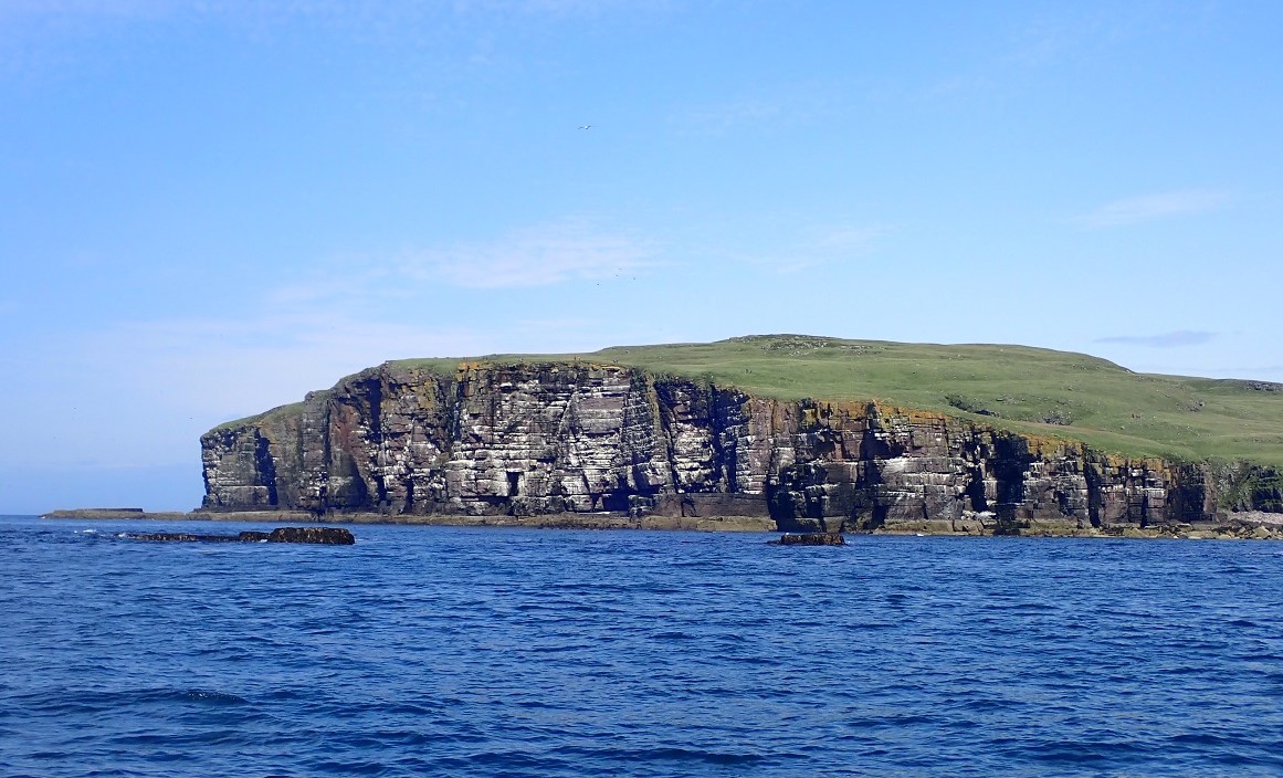
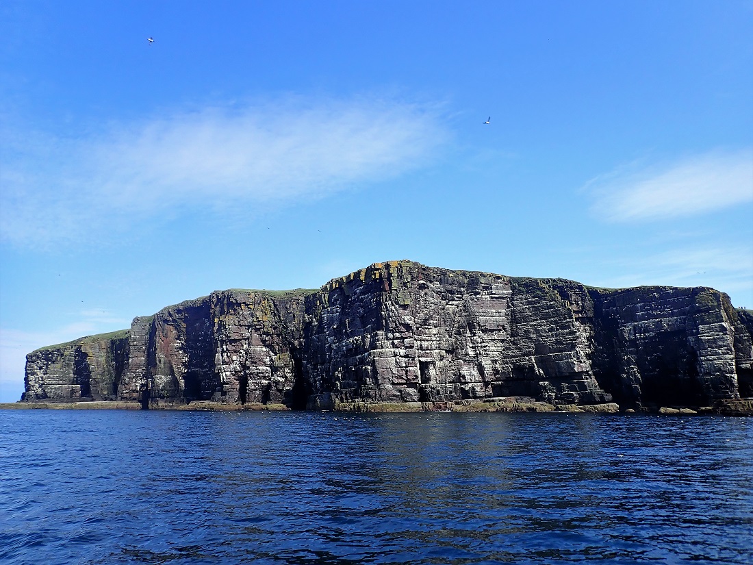
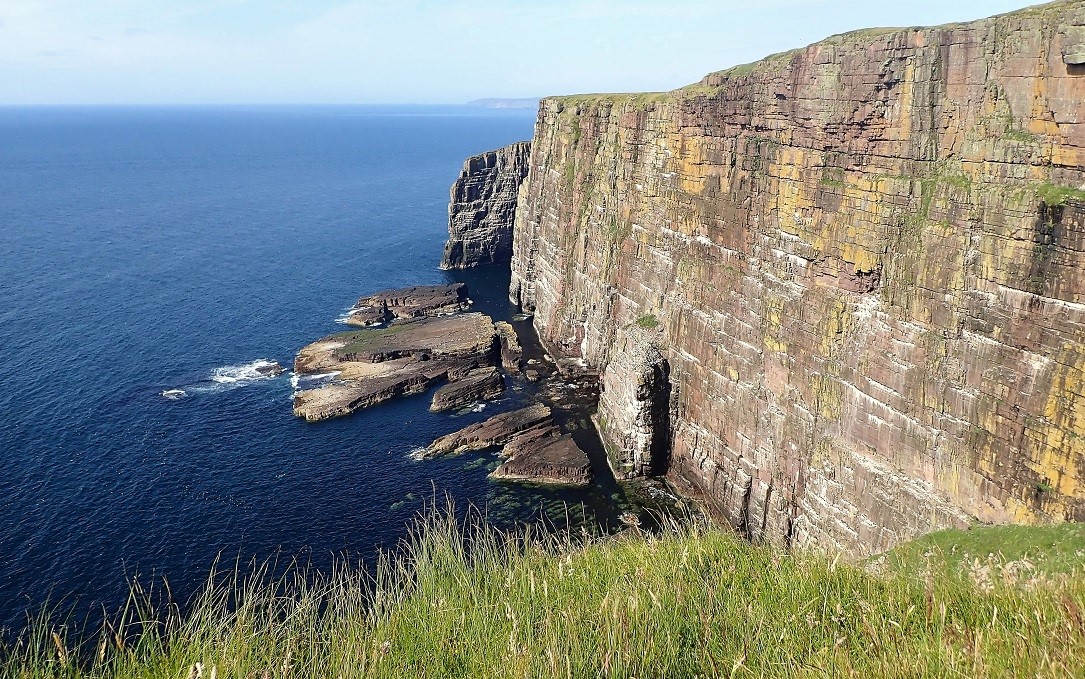
Rising dramatically from the Atlantic, the Torridonian sandstone cliffs of Handa Island offer one of Scotland’s most breathtaking natural spectacles. Located just off the coast of Sutherland and separated from the mainland’s ancient gneiss by the Sound of Handa, this 309-hectare wilderness reaches heights of 123 metres at its rugged summit.
A Summer Haven for International Wildlife
Every summer, Handa transforms into a bustling avian metropolis. Nearly 100,000 seabirds congregate on the island to breed, including internationally significant populations of:
Guillemots
Razorbills
Great Skuas (Bonxies)
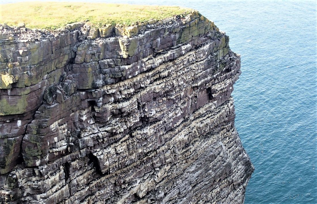
Nature enthusiasts can witness these species nesting across the sheer sandstone ledges, making it a premier destination for wildlife photography and birdwatching in Scotland.
The Rich History of Handa Island
Handa’s history is as compelling as its landscape. In ancient times, the island served as a sacred burial ground for mainlanders, chosen specifically to protect graves from the wolves that once roamed the Scottish Highlands.
The island’s social structure was famously unique, mirroring the remote communities of St Kilda and Mingulay. Life on Handa was governed by a “Queen”—the island’s oldest widow—while a daily “parliament” of men met to assign the community’s work.
Legacy of the Highland Clearances
In 1841, Handa supported a population of 65 residents. However, the devastating Potato Famine of 1848, combined with overpopulation, forced the entire community to evacuate and seek a new life in Nova Scotia.
Today, the island remains uninhabited, yet the echoes of its past endure. Visitors can still explore the haunting ruins of former dwellings and the visible “lazy beds”—ancient ridge-and-furrow cultivation systems—that stand as a testament to the industry and resilience of those who once survived on this remote Atlantic outpost.
Plan Your Visit
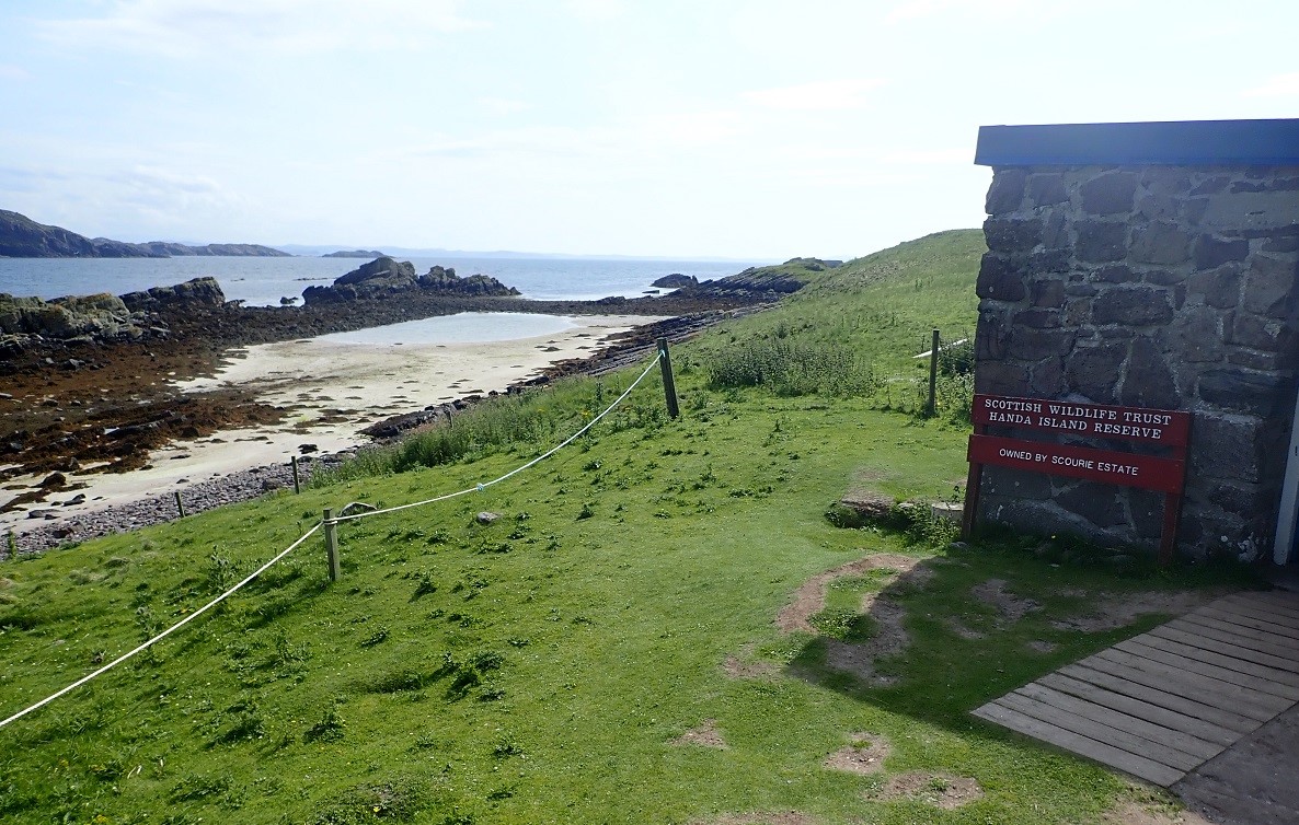
Handa Island is managed as a nature reserve. For ferry times and visitor guidelines, check the official Scottish Wildlife Trust website.
Scottish Wildlife Trust Nature Reserve
The island is of national importance for its birdlife and maritime vegetation and is a Scottish Wildlife Trust nature reserve. Handa is also a Site of Special Scientific Interest (SSSI) and a Special Protection Area (SPA). Handa also forms part of the North-West Sutherland national scenic area, one of 40 such areas in Scotland.
A small ferry sails to Handa from Tarbet on the mainland. The island receives around 5,000 visitors per annum.
Our visit by yacht
We had sailed from nearby Oldany Island to Handa, arriving to its south west facing sheer cliffs. The west coast of Scotland was at its ‘bluest best.’ Handa rose sheer out of the sea, layer after layer of ancient Torridonian sandstone stacked upwards to a verdant and vegetated top fringe. I nudged the boat to the foot of the cliffs as close as I dared. We lay drifting in the slight swell that had wandered across the Minch.

Witnessing Nature in Motion
The skies above Handa’s dramatic cliffs are a spectacle of motion. Thousands of seabirds expertly use the thermals, swooping and spiralling in a constant, dynamic aerial display.
Just below, life thrives at sea level. Seals can often be seen sunbathing peacefully on the warm, flat Torridonian sandstone slabs, lounging just above the gently lapping swell of the Atlantic.
A Destination Alive with Wildlife
Handa is not just a place of quiet beauty. Specifically, it is a vibrant ecosystem. Every corner of the island pulsates with life. You can hear the raucous calls of cliff-nesting birds. Meanwhile, seals maintain a serene presence along the shore. All of this exists within a backdrop of ancient, rugged landscapes.
Experience the raw power of Handa Island for yourself. It is a true highlight for any nature enthusiast. Furthermore, it is a “must-see” for geology buffs visiting the Scottish Highlands. The island offers a unique look at the history of our planet. Ultimately, it is a place where the earth’s ancient past meets a bustling, living present.
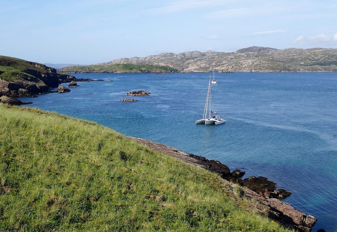
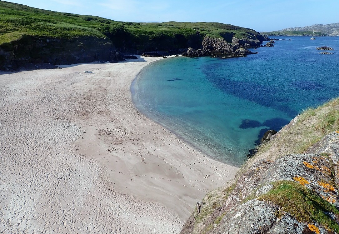
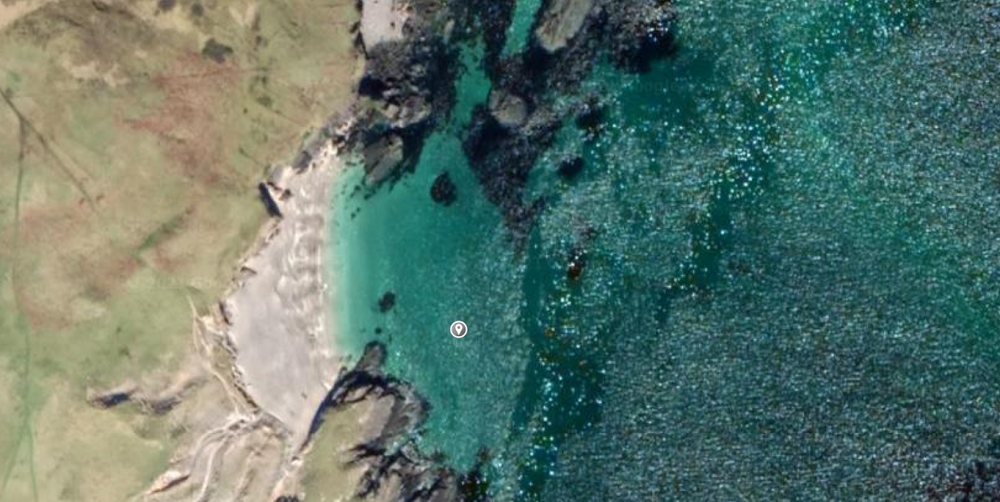
Dropping Anchor in Traigh an Tempull
We motor-sailed steadily along the shoreline. First, we passed Traigh Scourie Bay and Port an Eilein. We then rounded the headland into the Sound of Handa. Our goal was to anchor in Traigh an Tempull Bay. Pilot books note this as the only safe anchorage on the island.
However, pilots also warn of the dangerous tides and overfalls in the Sound. We maintained a constant vigilance. To our disappointment, two other yachts were already anchored in the bay. Their positions limited our choices in the shallow water. Nevertheless, we dropped our anchor and settled in the calm bay.
Just 30 meters behind us, the incoming tide flushed water northwards. We waited for several minutes to ensure the anchor held fast. Once satisfied, the three of us headed for the shore in our rubber dinghy.
Exploring the Island of Handa
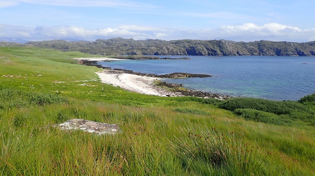
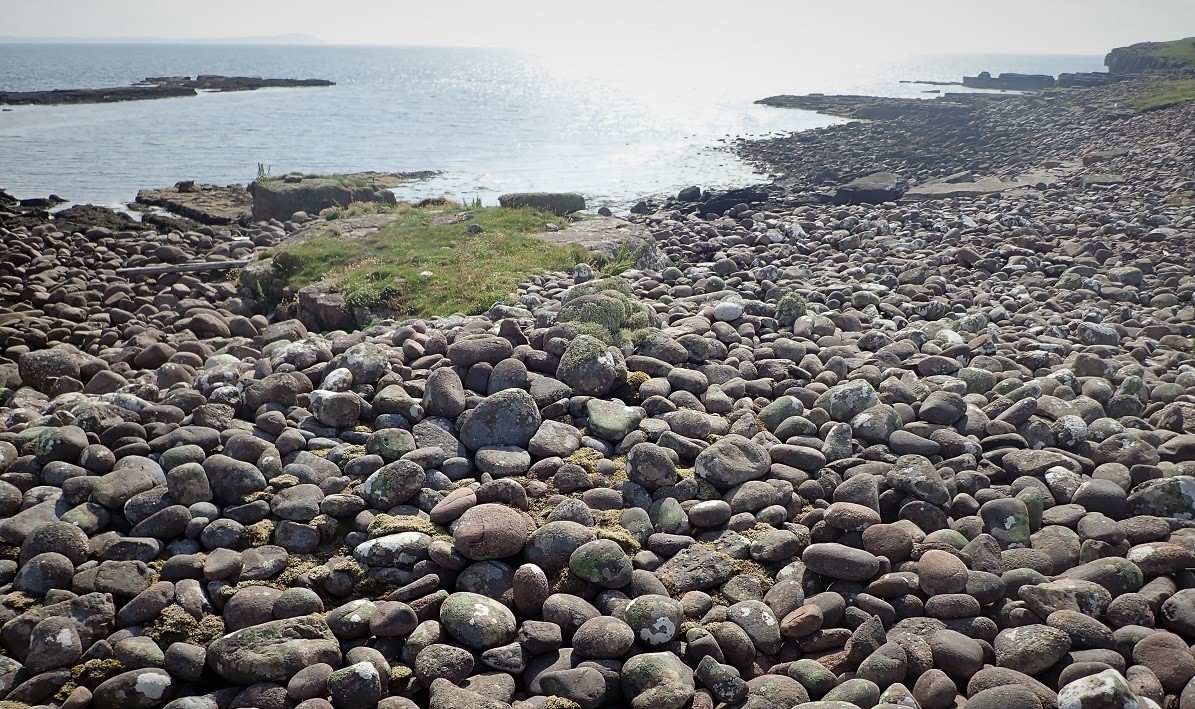
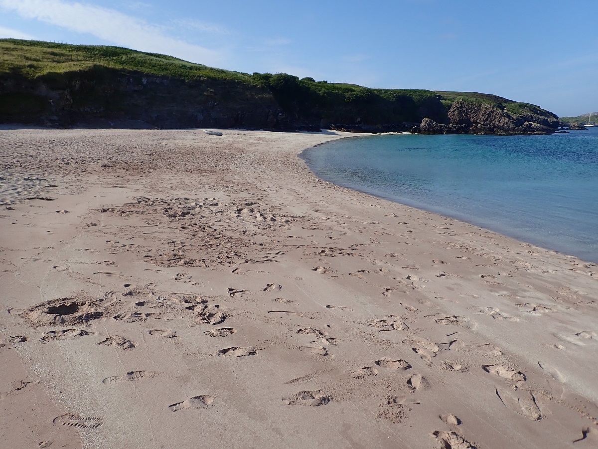
Handa receives over 5,000 visitors every year. We landed on a wonderful sandy beach. Specifically, we shared the shore with thirty people waiting for the mainland ferry. I did not hang around for long. Instead, I headed through the dunes to find some peace.
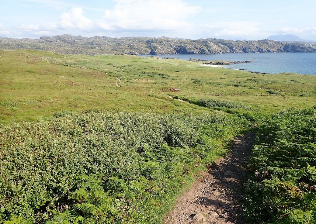
My plan was to run around the island. I left the others and headed along the south shore. Consequently, I began a clockwise circumnavigation of Handa. I passed the Warden’s bothy and followed a well-maintained path. The trail led me toward the high cliff tops. Previously, we had only seen these massive cliffs from the deck of Trade Winds.
An Unlikely Visitor
I encountered several groups heading for the last ferry of the day. Suddenly, a ranger approached me. She was the “sweeper” responsible for the island. She wanted to ensure no visitors remained stranded overnight. I assured her that I was staying on a yacht.
Consequently, she set off to find any other errant visitors. I smiled at her sincere enquiry. Every other person I met carried binoculars and backpacks. They looked like perfect “twitchers” in their natural environment. In contrast, I wore only running shoes, shorts, and a bum bag. I was certainly not the archetypical birdwatcher.
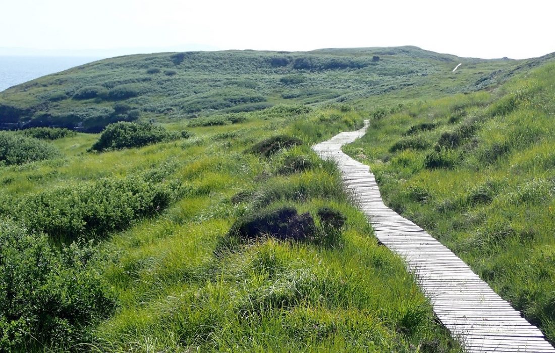
The Forever Boardwalk
The path soon gave way to a ribbon of boardwalk. It stretched and snaked across the grassland until it vanished from sight. Specifically, the wood felt incredibly sound under my feet. I had never run on such a long and impressive structure. Ultimately, it felt like a highway through the wilderness.
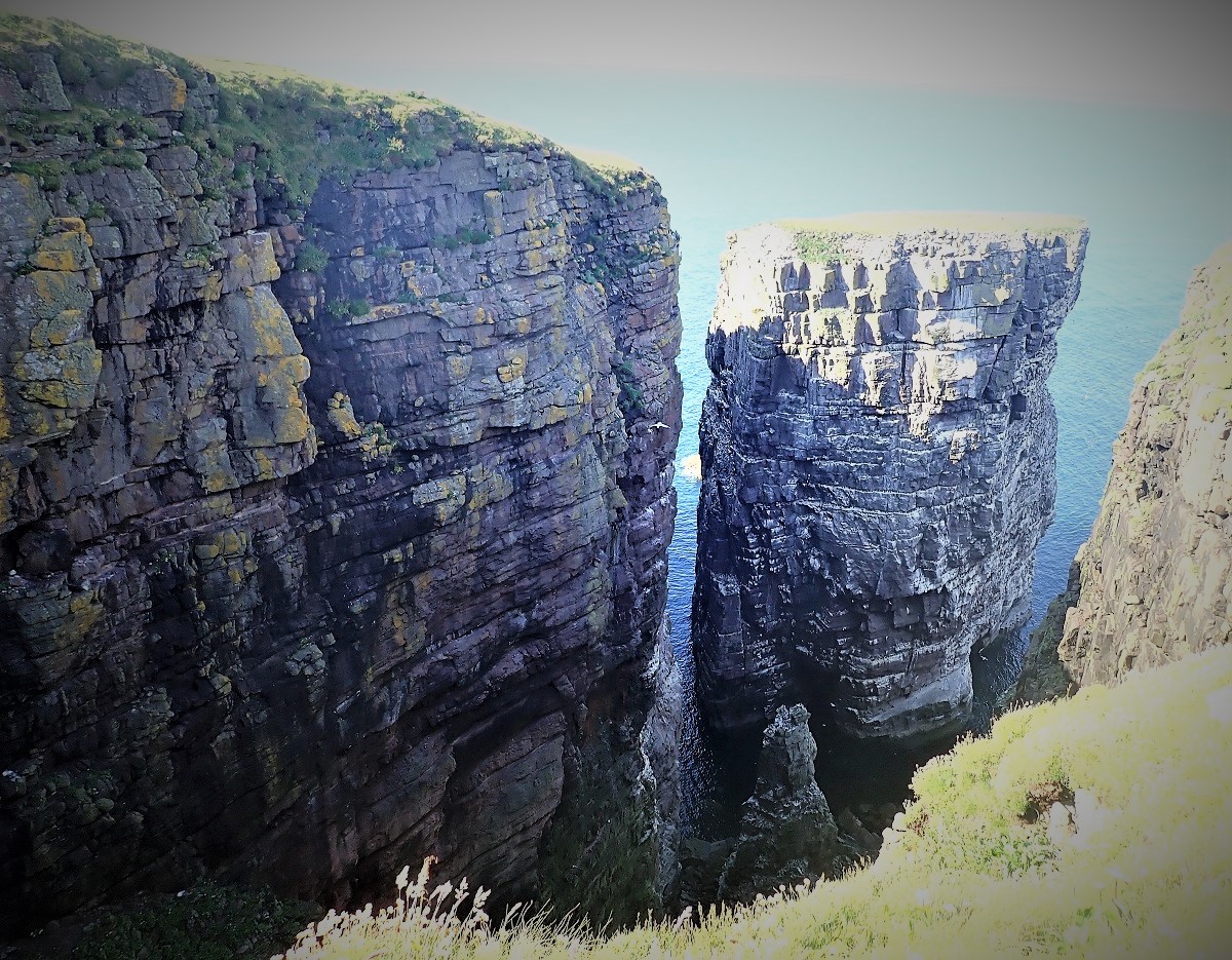
The Rock Window
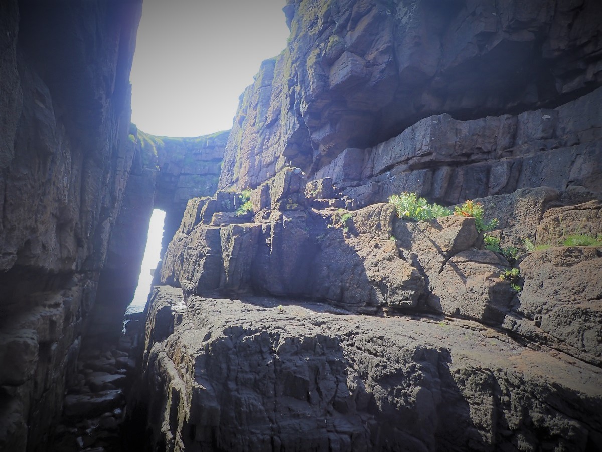
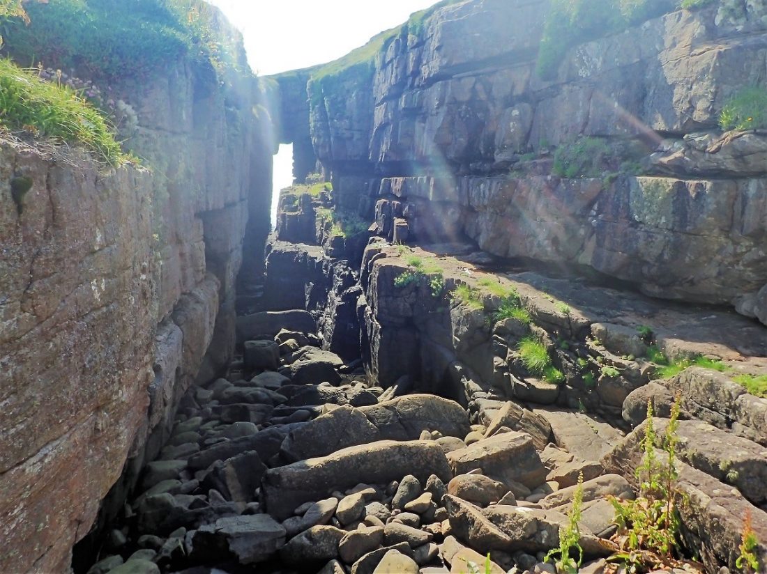
We had previously spied a wonderful stone arch from the boat. Immediately, we christened it the “rock-window.” It was certainly worth a detour from the main path. The arched square gap in the cliff face was truly massive. Specifically, it looked just as impressive from the land as it did from the sea.
The stone frame perfectly captured the light of the afternoon sun. Consequently, it felt like a natural portal looking out over the Atlantic. Standing there, I realized how small our human structures are compared to these ancient gates of stone. Ultimately, the arch stands as a monument to the relentless power of the waves.
Running the Cliff Edges of Handa
The next thirty minutes of running were truly inspiring. Specifically, the clifftop path offered a wonderful view over the sheer drops. The air teemed with thousands of nesting birds. In places, I crept flat on my belly to look over the edge. I inched as close as I dared to the dizzying precipice.
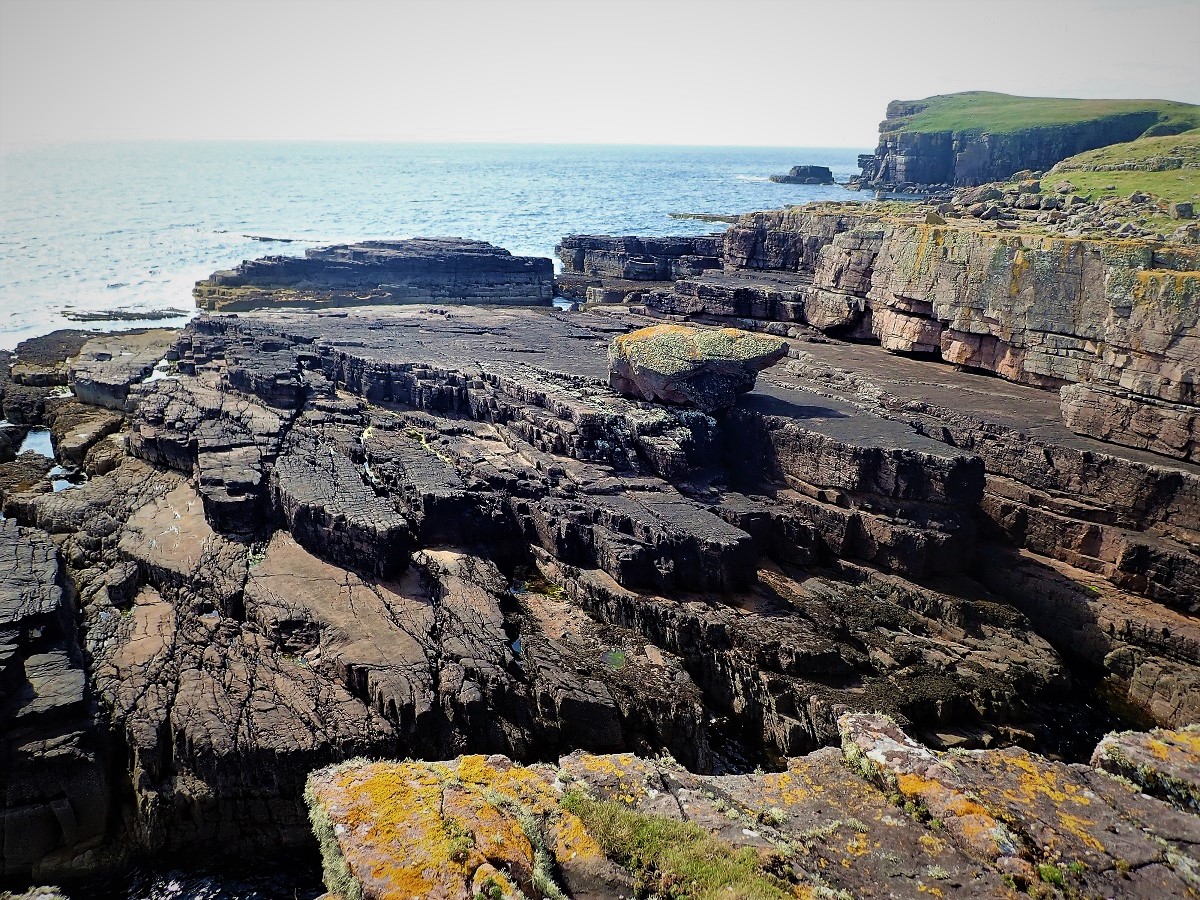
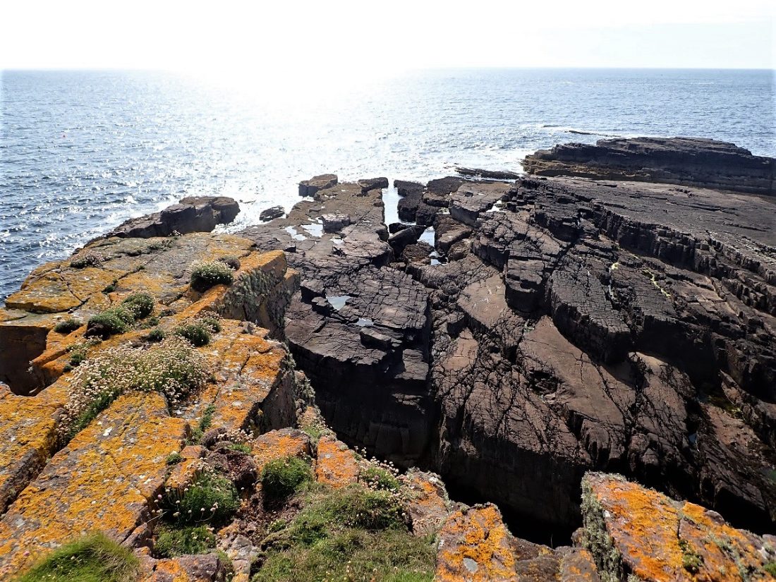
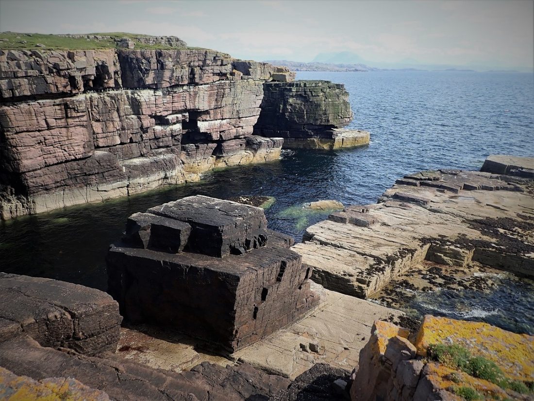
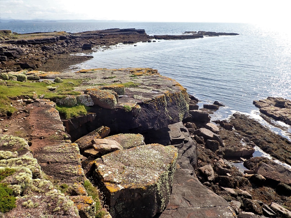
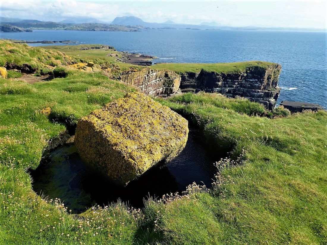
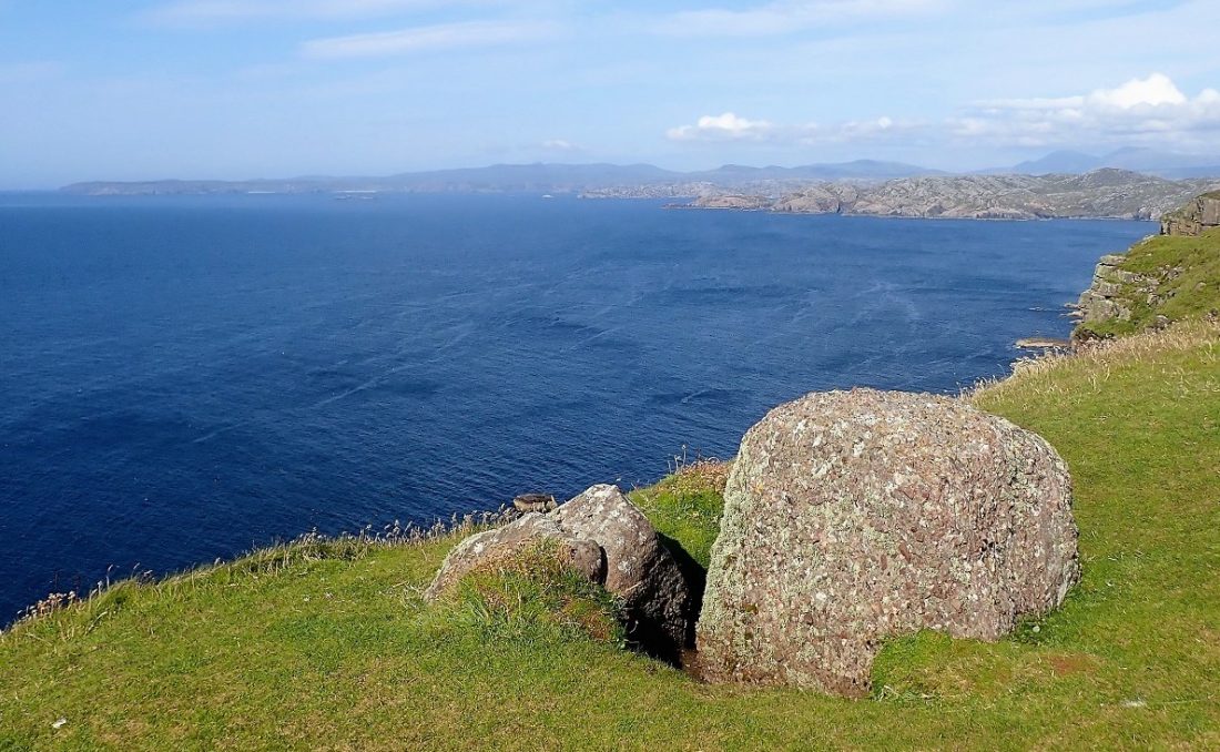
The island presents a wall of bare stone to the westerly weather. Consequently, the landscape shows the scars of constant battle. Massive blocks of sandstone have succumbed to the incessant weathering. Some lay detached from the mainland. Meanwhile, others lay awash in the crashing surf far below.
These stones are the remnants of ancient sea stacks or fallen cliff faces. In some areas, Handa stands sound and unbowing. One hundred meters of sheer cliff prove the solidity of this place. However, other sections are a shambles of surrendered sandstone. Slabs and cubes lay tumbled into the water in a state of beautiful chaos.
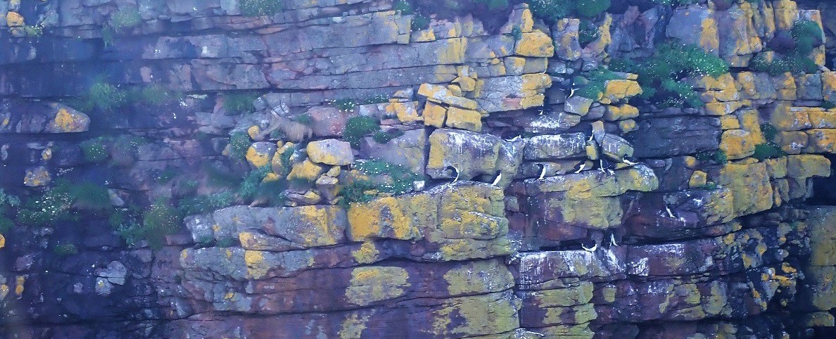
The Scottish island of Handa is home to the UK’s largest population of guillemot and is the breeding home to enormous numbers of razorbill and kittiwake. There re also large populations of breeding: gull species, shag, puffin, black guillemot along with arctic and great skua.
The famous sea-stack; Stacc An T’Seabhaig stood tall. The stone whitened by guano of the Razorbills that occupied every ledge and nook. I sat on the dry grassy top watching the Puffins and Razorbills swoop and soar.
Time to head back
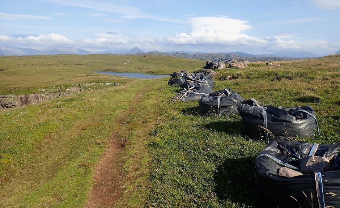
It was a perfect spot to stretch out, watch the birds and drift off into a peaceful power nap. However I had committed to an agreed ‘return time’ and did not want to cause any concern by being late. The grass path back across the island was lined with builders’ bags. Soon, no doubt to be laboured into a grit path.
The Return Journey
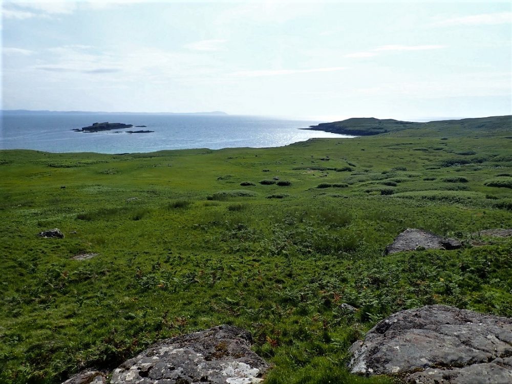
The return leg across the middle of the island was a pure delight. Specifically, the path led slightly downhill most of the way. I ran along sections of the sturdy boardwalk under a bright afternoon sun. These surroundings were truly inspiring.
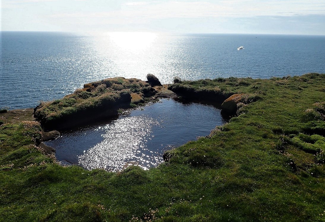
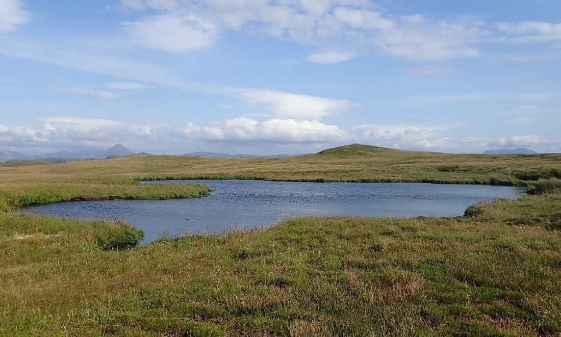
Furthermore, the landscape opened up to reveal the island’s interior. Over to the left, I saw one of Handa’s six freshwater lochans. These small bodies of water are unique. Interestingly, each one is entirely devoid of fish. Ultimately, the quiet beauty of the moorland provided a perfect end to my island circumnavigation.
The Missing Summit
My only disappointment was that I did not “summit” Handa. Specifically, the Rangers had advised me against heading to the highest point. There was no designated path to the top. Consequently, wandering walkers or runners could easily disturb the ground-nesting birds.
I had a momentary, defiant thought to strike for the peak anyway. However, I soon concluded it was not the end of the world to miss the summit. The island had already provided a spectacular day. Handa delivered beauty from sea level to the high cliff tops. Ultimately, I was happy with what I had seen. I made my way back to the now-deserted beach. Only our footprints remained alongside the marks of the multitudes that came before us

We paddled back out to Trade Winds and made our way on a following wind to Loch Laxford for the evening.
Final Thoughts on Handa
I cannot praise the condition of Handa highly enough. Specifically, there is a clear level of meticulous and passionate care for the island. The Scottish Wildlife Trust manages the land with great dedication. Consequently, the island remains a pristine sanctuary for both wildlife and visitors. More information is available directly from their website.
Anchorage: Traigh an Teampuill
We anchored in Traigh an Teampuill bay on the east shore. This bay offers shelter from moderate westerly winds. However, it is a tight space for more than one yacht. You must be careful of submerged rocks at the top end of the bay. Furthermore, another “brick” or rock is noticeable just off the bottom corner of the beach.
Ultimately, you should choose to anchor well off the sandy beach. Pilot books and Haswell-Smith both warn of the tidal currents that “rip” through the sound. The flow was quite evident only 20m from our stern. Fortunately, our anchor held firm on a sandy bottom in 8m of water. Watch out for the regular ferry boat wash. It can easily spill your coffee or cold beer.
Near by Scotislands
Image Gallery